
Falls view from half-way up the trail

All photos by Ravell Call
Why enjoy America's tallest waterfall, Yosemite Falls, only from the bottom?
A 7.2-mile round-trip hike in California's Yosemite National Park, will take you 2,700-feet skyward for a bird's-eye view of the spectacular plunge, seventh tallest in the world.
Now this isn't a "walk in the park," it is classified as a "strenuous" hike by the National Park Service. It recommends having six to eight hours to complete the trek.
If there's one key word hikers will learn traveling this trail, it is "switchbacks," as there are more than 120 to negotiate.
"How many more are left?" is a common query overheard along the path. "Switchbacks galore" is how one hiker described the trail.
"Lots of switchbacks up the trail and it gets moderate crowds — like everything else in Yosemite? but worth it," Arthur Dugbee from Indianapolis wrote on Summitpost.org after his hike.
The Falls overlook.
A bronze model of the falls and switchbacks is located just north of the parking area for the Lower Yosemite Falls paved path. It is here where the best preview of what hikers undertake is to be found."Whew, what a set of stairs!" is how another hiker described it.
While scrutinizing that model, a middle-aged outdoorsman from Alaska walked by and offered a 10-minute recount of his experiences there the previous week. Even though he didn't make it to the top, because of snowy weather, he still thought it was a great experience.
He also cautioned that coming downhill isn't easy either, because of the loose gravel and dirt on the sometimes wet, rocky trail steps. That's why older hikers may want hiking poles for this expedition.
The Upper Falls Trail, one of the oldest in Yosemite, was constructed between 1873 and 1877. Superbly engineered, the trail is cut back in the mountain and offers plenty of comfortable margins from cliffs and drop-offs.

Shade dominates the first half of the trail. Some of the middle trail also goes downhill for a 600-yard stretch as it curves toward the falls. The middle section also includes chances to see rainbows and some misty but refreshing showers from the nearby falls, depending on the wind.The trail begins about 0.3 of a mile northwest of Yosemite Lodge, near the "Camp 4" parking lot (formerly "Sunnyside), or shuttle-bus stop 7.
Even if you only go a mile up the trail, the Columbia Rock viewpoint offers panoramic looks at the valley. This is significant, because the lofty Glacier Point viewpoint is often not open well into May and this is a worthy alternative.
"Do not stray off the marked path, as you will find steep drops adjacent to the trail," the Park Service's trail guide warns.
Is that warning justified? Yes. Of the 13 recorded deaths along the Upper Falls Trail since 1927, all but one involved hikers taking shortcuts or scrambling off the marked trail. The other death was a 17-year-old in 1980 who was running down the trail out of control and somehow ended up falling 600 feet.
(One of the trail fatalities was Steven Leroy O'Neal from Salt Lake City, who scrambled off trail to his death on Feb. 23, 1980.)

Signs also warn of falling rocks along the trail. This too is justified, because one fateful day in November 1980, a slab of granite 200 feet high and 60 feet wide broke off above the central portion of the Upper Falls Trail, killing two hikers and injuring 20.

The actual summit, to the west of the Falls.
Notwithstanding such tragedy, thousands safely hike this trail each year by using common sense and remaining on the path. Extra caution should be exercised on the trail where it is wet and slippery.


Hikers on top need to watch the trail signs and avoid the longer segment that continues north along Yosemite Creek into the backcountry. Swimming in the creek topside is also not advised.
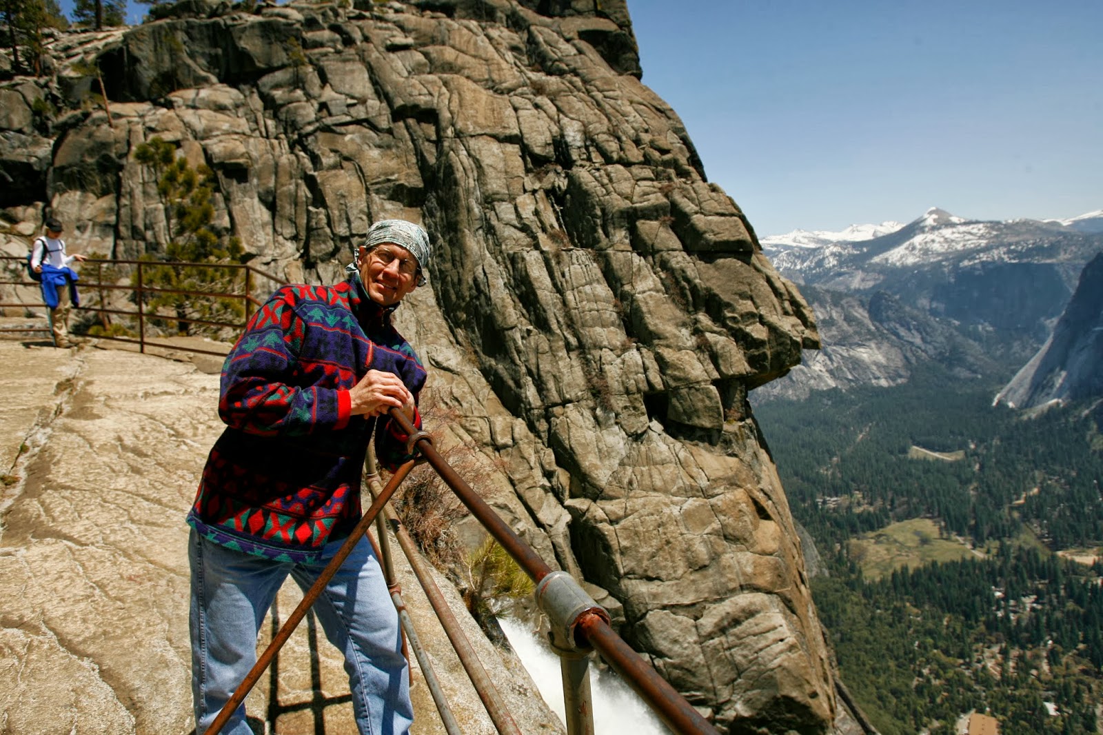
Many large rocks offer rest along the mountain skyline. From there, the trail continues downward several hundred feet to a fenced off observation area. A narrow path cut in the rock, complete with a metal railing to hold on to, leads there.
The views are indeed stupendous from the overlook.

This trail is usually only open halfway up the mountain in the winter and spring is the best time to hike the falls, when the water flow is at its greatest. In late summer and fall, the falls may just be a trickle or even dry altogether.
For more information, go to: www.nps.gov/yose
(-Originally written by Lynn Arave in the Deseret News, June 18, 2009.)

No comments:
Post a Comment